Traditional examination (by ground or by helicopter) is expensive and it is difficult to measure error rates. This method can be replaced with our accurate and efficient aerial inspection. UAV surveys help clients to effectively identify and manage potential issues observed in well inspections, pipeline inspections and facility inspections. Based on our customers’ data, UAV inspections are 50% less expensive than those completed by helicopter. More importantly, using our automated analyses, the accuracy of the inspections is greatly improved.
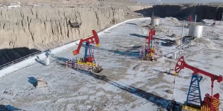
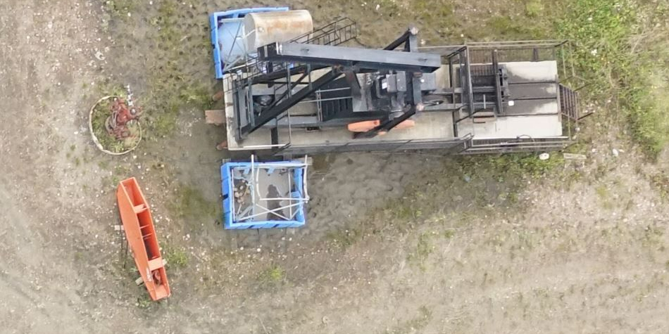
Petroleum Wells Inspection
The surface rust and cracks can be monitored remotely through the fusion of optical and thermal sensors on the UAV. The data is then analyzed by convolution neural networks to identify features that indicate pending issues. UAV inspection is particularly effective for hard-to-reach areas.
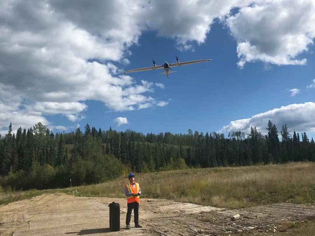
UAV flies over petroleum wells
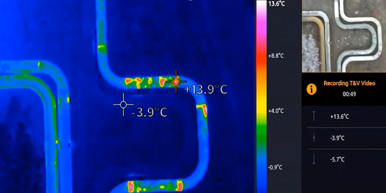
Thermal and optical simultaneous inspection
Pipeline ROW Inspection
According to Province of Alberta’s Pipeline Act, the licensee of a pipeline shall, at least once annually, inspect the pipeline right of way (ROW). The purpose of ROW inspections is to monitor the condition and potential impacts, so that prompt and appropriate remedial action can be taken when the system is damaged, or the integrity of the system is threatened.
Drones have the ability through video and aerial photos, to help in scouting and routing and give a view without having to send crews out on foot. Drone inspection is efficient and safer than ground-based surveys, especially where the terrain is difficult, such as around water crossings or in areas where bears are prevalent.
UAV Pipeline Right of Way Inspection
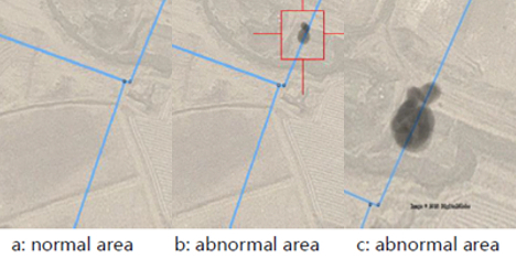
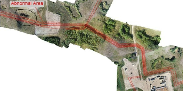
Pipeline leak AI inspection
Reclamation Inspection
UAVs can be used to monitor reclamation performance while decreasing costs. The process begins with combining LiDAR and imagery data to one platform. Drones capture everything happening on the ground with more detail. Our UAV reclamation solution can reduce ambiguity, create accurate plans, and streamline communication during the reclamation lifecycle.
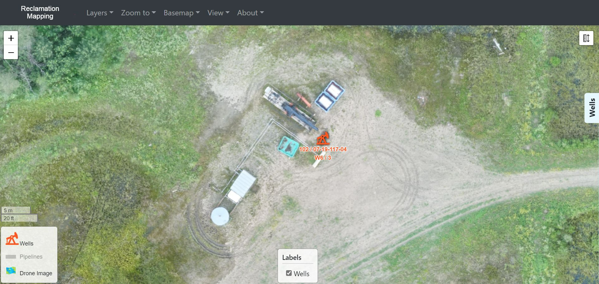
Reclamation monitoring platform
High resolution (5cm) imagery to see more details
If you need brochure, quote, please contact us: geomatics@westernheritage.ca or 1-877-669-0784