Western Heritage offers a wide range of geotechnical solutions including near surface geophysical studies and geo-archaeological services. These solutions provide important information for projects where uncertainty exists. Western Heritage provides these services as part of heritage management services or as stand-alone services to answer specific questions, such as cemetery studies, locating unmarked burials, OSL dating and site formation processes.
Ground-Penetrating Radar
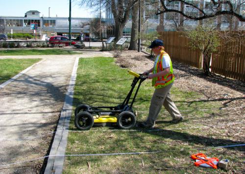
Ground-penetrating radar (GPR) uses reflected radar pulses to see under the earth’s surface without digging or drilling. GPR can be used on most surfaces and can detect subsurface changes to a depth of several metres.
Western Heritage uses GPR equipment from Sensors and Software, a leading Canadian manufacturer. Our SmartCart GPR unit collects and displays data in real time, and can be used in variable conditions or on difficult terrain.
GPR is ideal for:
- Industrial or historical sites known or suspected to hold buried cultural features or objects (pits, pipes, trenches, foundations or graves)
- Sites with hard surfaces, where digging is difficult
- Locations where intrusive excavation must be kept to a minimum
- Cemetery mapping and non-invasively locating unmarked burials
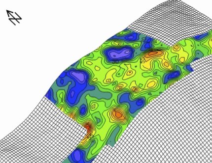
- Ground-penetrating radar works in many environments, and nearby electrical power sources are not an issue. Using GPR, we can evaluate large areas in real time and quickly process data to generate 3D maps of subsurface features – all with no excavation.
Magnetometry
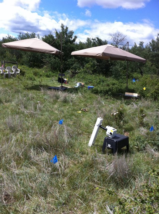
Think of geophysics as a way of collecting new kinds of data from archaeological sites. Magnetometry is a branch of geophysics, and a tool for exploring the earth to learn about its nature and content.
Western Heritage can measure the magnetic properties of a site to locate and identify cultural features. We use a GeoScan FM256 Gradiometer as our primary magnetic data collector.
Magnetic surveys can show the location of pits, burn areas (campsite hearths), structural remains, iron artifacts and other features of vital interest to archaeological interpretation.
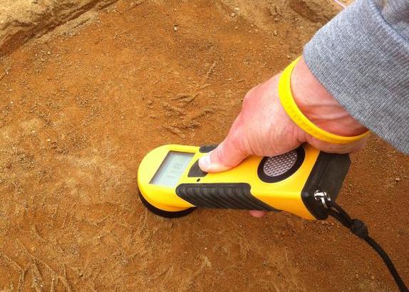
Magnetic Susceptibility
Magnetic susceptibility is a measure of a material’s ability to become magnetized by an external magnetic field. The magnetic susceptibility of a soil reflects the presence of magnetic iron-oxide minerals, which can be formed by burning or microbial activity. Human activity has an important effect on magnetic susceptibility in soils – examples include fires or garbage decomposition. As a result, magnetic susceptibility can help identify areas of archaeological potential before excavation; it can also identify hearth areas and the presence of burning residues. When measured in a systematic way, magnetic susceptibility can be used to detect evidence of human occupation even when no distinctive archaeological features have survived.
Detailed Stratigraphic Mapping
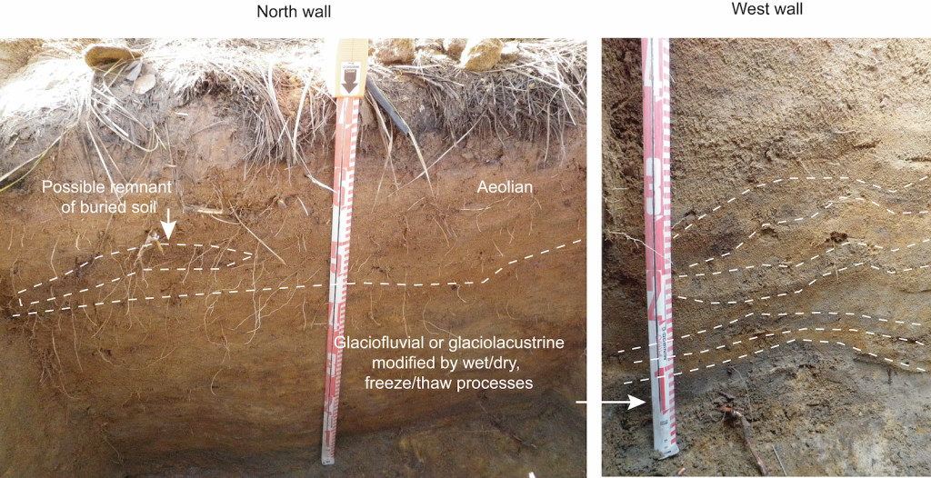
A lack of information regarding the significance of an archaeological resource results in inadequate knowledge for heritage management planning during project development. Detailed stratigraphic mapping provides more accurate knowledge of the extent and nature of any historic/heritage resources that may be present within the footprint of a proposed development, appreciably reducing uncertainty and improving the accuracy of historic/heritage resources assessments.
Our interpretations are based on systematically collected data using science-based methods, producing meaningful and long-lasting results.
Soil Micromorphology
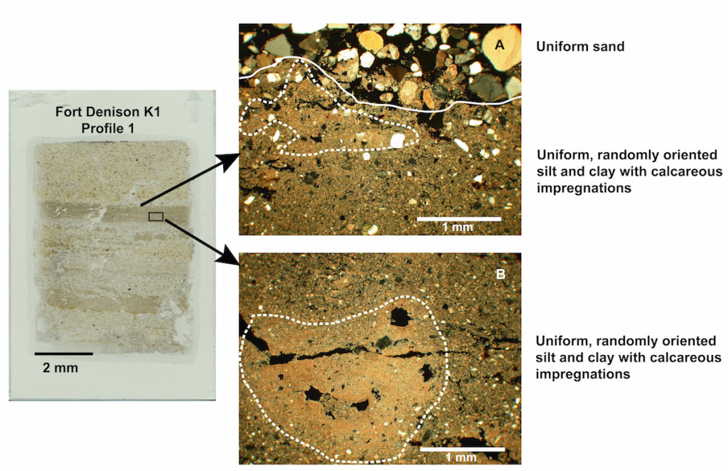
Soil micromorphology (thin section analysis) is the microscopic examination of undisturbed soils. This technique allows soil components (i.e. mineral and organic particles, post-depositional features) to be observed in relation to each other. In archaeology, soil micromorphology is used to address specific questions, such as:
- documenting land use and soil management
- defining activity areas within archaeological sites
- investigating post-depositional processes acting at the site
- identifying site formation processes
- establishing the relationship of cultural and natural elements (i.e. artifacts and sediments), a key aspect of interpreting chronometric dates (i.e. radiocarbon and luminescence)
OSL Profiling
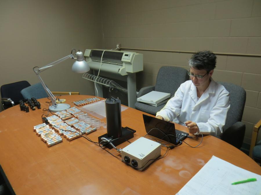
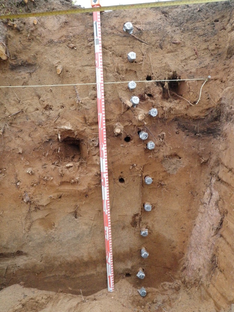
Western Heritage is one of the first organizations worldwide to employ and refine recently developed optically-stimulated luminescence (OSL) technology using a portable OSL reader (POSL). This can be used to estimate relative ages, document depositional history dynamics, and examine mineralogical changes. Western Heritage is routinely applying POSL analysis in our work in the fields of heritage management, research and mitigative excavations.
The portable optical reader is proving to be a valuable tool for use in:
- evaluating disturbances (e.g. bioturbation, cryoturbation, and human disturbance)
- constructing relative chronologies
- assessing fluctuations in the rate and process of sediment deposition through time
- identifying stratigraphic breaks in homogeneous-looking sediments
Applications to archaeology include:
- enabling more informed decision-making regarding the selection and interpretation of samples for formal chronometric dating (OSL or radiocarbon), allowing for more efficient expenditures of project resources
- assisting in determinations of the heritage value of archaeological sites by:
- helping to discern multiple occupations within homogeneous-looking stratigraphic profiles
- supporting estimates of relative age, particularly at sites containing no time-diagnostic artifacts
- allowing informed assessments of disturbance and non-disturbance
- addressing archaeological questions and testing hypotheses